Geospatial Cell Options
Overview
This document covers custom cells for geospatial (map) visuals and interactions in your templates. The options include:
- Map, and
- Google Maps opening.
 Map
Map
More details on using this custom cell can be found in the “Template Techniques\General\Using Maps in Analyses” guide. The Qarbine Administrator must define a Mapbox token to use the map custom cell. Instructions to do this are within the Tools;Administration Tool area of http://doc.qarbine.com.
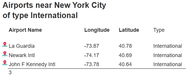
Below is an example of a report that has geospatial information.
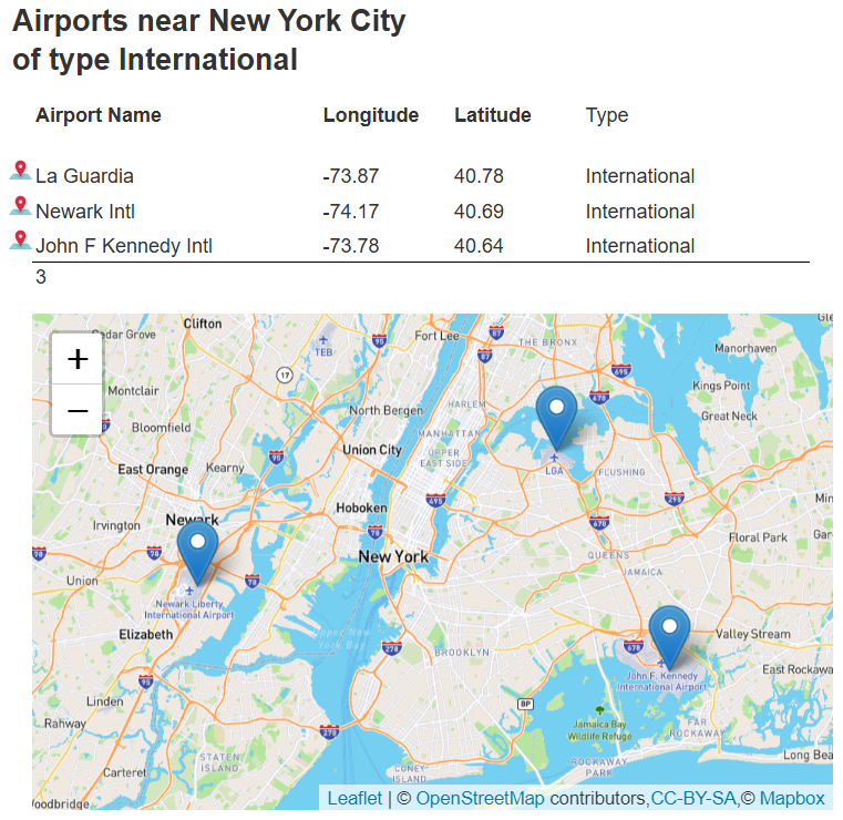
It is in the catalog at “example/Qarbine techniques/Geospatial/Airport detail map”.
For this custom cell the formula may be one of the following:
- the specific map center with lat and long fields, or
- "centerOfObjects".
For the first you can create a point object using these formulas:
- pointFromLongLat(x,y),
- pointFromGeoJsonHolder(geoObject [, label]), and
- pointForCity(commonCityName).
Using “centerOfObjects” results in the center based on any markers, polygons, and other shapes.
The custom cell properties are shown below.
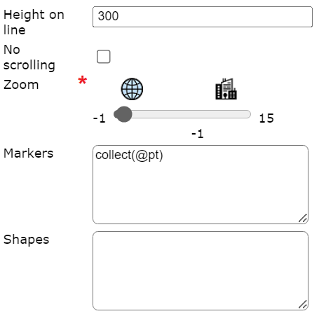
The markers value is a list of objects with lat and long fields. Points can be created using pointFromLongLat(x, y [,label] ) or other related geo functions noted above.
The optional list of shapes has mapPolygon or mapCircle elements. Each polygon has a list of elements with lat and long fields.
 Map View Button
Below is an example of a report that has geospatial information with buttons to the airport name’s left which opens Google Maps..
Clicking the icon opens Google maps on the given location.
The cell formula result may be:
- "next" indicating the value is in the next cell on the line,
- "previous" indicating the value is in the previous cell on the line, or
- the point location itself.
The location is a Point object with lat and long fields. These functions may be useful to create the point object:
- pointFromLongLat(long, lat),
- pointFromGeoJsonHolder(geoObject), and
- pointForCity(commonCityName).